Saturday, September 12, 2015

The Great Southern Utah Road Trip - August 26 - Part XVI - Route 9 through Zion National Park

It was time to head back to St. George. Despite warnings on the National Parks web site, there were no indications of road construction, so Holly decided to take the direct way back on Route 9 through Springdale. I didn't realize that we would be driving through the lower end of Zion National Park until we came to the entrance. We showed our lifetime Senior Passes and went right in. It was spectacular!


We saw some young Bighorn Sheep by the side of the road, but couldn't stop for photos. 


Continuing on ...  more spectacular scenery.


We went through some long tunnels carved into the towering canyon walls.


Here's Holly photographing one of the arched windows of a very long tunnel we passed through.


Friday, September 11, 2015

The Great Southern Utah Road Trip - August 26 - Part XV - Kanab, Best Friends Animal Sanctuary, Mt. Carmel

We had a reservation for a tour at Best Friends Animal Sanctuary for Wednesday morning, so decided to spend the night in Kanab at Aiken's Lodge, a mid-century style motel recommended by Best Friends. It poured with rain that night.

On Wednesday morning, it was still pouring with rain when we set off for our first tour at the Best Friends Animal Sanctuary
We enjoyed our 45-minute morning Wild Friends tour with a most delightful guide. (She talked non-stop. We were told that she arrives at 3 a.m. to feed the wild animals and that the 10:15 a.m. tour is her last duty of the day. Before she starts the tour, she is reputed to drink two Red Bulls!) 

Best Friends was not initially approved for wildlife. However, so many people brought wild animals to the sanctuary that they applied for state and federal licenses, hired licensed rehabilitators, and built a rehabilitation center. Among the animals we saw were a seagull, a snow goose, a European goose, three beautiful, playful sleek minks (one brown, one jet black, one pure white), a barn owl, a peacock, roosters, crows, a red-tailed hawk, and two ravens (Edgar and Nevermore).
We were directed to Angel Village for lunch. For $5 we were treated to a delicious buffet and salad bar. Since it was still pouring, we didn't see much of the beautiful canyon overlook from the dining room terrace.

We headed back on the highway to the sanctuary's main entrance for the general tour by van.


The road up Angel Canyon had become muddy and impassable during the night, so we were unable to see much of the canyon area or go to Angel's Rest. However, wwere able to visit a cat care faciity (for FELV cats) and a dog care facility. Because there were only five of us, we were privileged to feed treats to a very shy dog who was slowly being socialized.

On our way out we saw horse corrals and views of Angel Canyon.


Before heading back to St. George, we took a detour to Mt. Carmel. We visited the Thunderbird Foundation for the Arts, a lovely gallery devoted to the works of Maynard Dixon and artists who paint in the areas where he painted. The owners are also caretakers of the nearby Maynard Dixon residence.

The Great Southern Utah Road Trip - August 25 - Part XIV - Kodachrome State Park

At Cannonville, we decided we had time to take one more side road off Scenic Byway 12. After a brief stop at the Grand Staircase-Escalante Visitor Center, we headed south to Kodachrome Basin State Park.
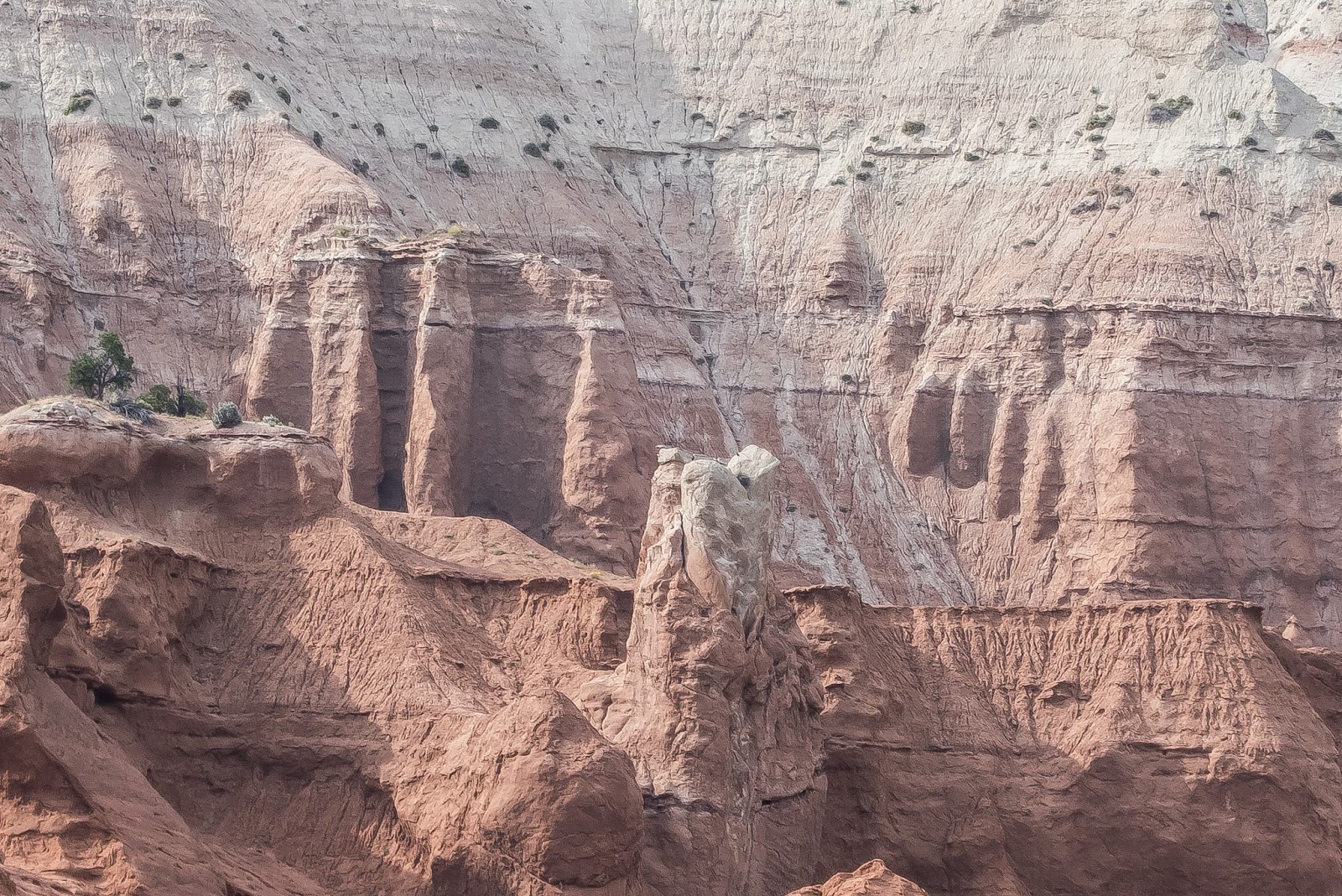
Kodachrome Basin was named during the late 1940s by a National Geographic Society Expedition in honor of the then revolutionary Kodak film that was celebrated for its color accuracy. The park [contains] unusual geological forms, including a series of upright cylindrical chimneys called sand pipes. More than 60 sand pipes ranging in height from 6 to 170 feet have been identified in the park. A Route Guide to Scenic Byway 12
Geologists believe Kodachrome Basin once resembled areas of Yellowstone National Park, and that the sand pipes are remnants of ancient geysers and hot springs which filled with sediment and then solidified. Over time, the encompassing Entrada sandstone, formed during the Jurassic era, eroded away to leave behind the unique, multi-hued rock formations standing today.  Kanab Magically Unspoiled - Kodachrome Basin
We drove through the park on the paved road section, stopping from time to time to take photos.


And then on to Kanab.

The Great Southern Utah Road Trip - August 25 - Part XIII - Back on Route 12

Back on Scenic Byway 12, we headed for Kanab, where we had decided to spend the night. On the way, I took photos as we drove.


Between Boulder and Escalante, we stopped at the Boynton Overlook.
Boynton Overlook gives visitors a bird's-eye view of the riparian area along the twisting Escalante River. Flowing water and native vegetation offer ideal habitat for small birds and animals, including river otters which were reintroduced here in 2005.  The overlook was names for John Boynton, a cattleman caught in a lawless confrontation involving a disagreement over livestock and a murder in 1878.  A Route Guide to Scenic Highway 12


Between Escalante and Henrieville, the scenery changed dramatically. We pulled out at The Blues/Powell Point Overlook.
The Blues Overlook sits across from the delicate pink limestone ledges of Powell Point, which rises to an elevation of 10,188 feet, and above "The Blues," a badland of gray-green shales deposited some 80 million years ago when the area was covered by an inland ocean. Powell Point was named after John Wesley Powell, who led expeditions in the late 1800s to map this region which at that time was one of the last "blank spots on the map" of the continental U.S. Hidden within the slopes of "The Blues" is one of the best and most continuous records of Late Cretaceous life on the planet.  A Route Guide to Scenic Byway 1


As we continued west toward Henrieville, Powell's Point showed us its magnificence.